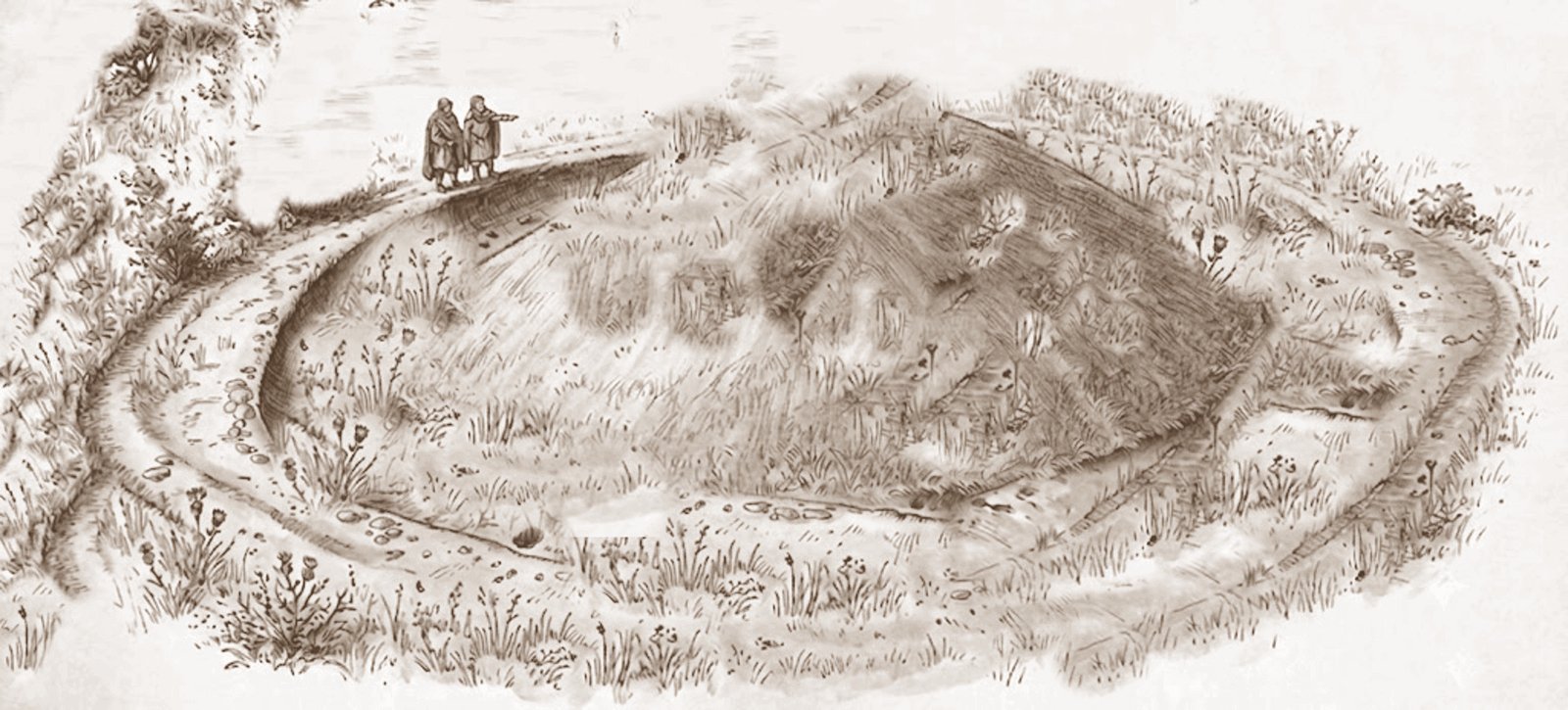
The image above is AI generated and is not a sketch of the actual lost barrow at Easole. It is intended to give a general impression as to how the barrow and ditch may have looked in its later years.
Two 16th century documents, a manorial rental of 1501 and a conveyance of land 1550, respectively refer to a feature known as Essolebyrg’ (from the Old English beorg, meaning barrow) and Esollbarow. Both documents concern land owned by the Boys family of Fredville.
The precise location of this barrow in Easole had for many years proved elusive as there were no obvious remains to be seen from the ground, but by good fortune a random online search in March of 2024 using the Bing search engine revealed a ring ditch crop mark in the field to the east of the Sandwich road opposite the entrance to Old St. Alban’s Court.
This field was recorded as Malt House Close on the 1839 parish tithe map and the 1859 Poor Law Commissioners map for Nonington, and later as Dog Kennel Field on the 1928 OS map and the ring ditch is located in the north-eastern corner of this field.
There are at present no known references to the barrow at Easole after the 1550 land conveyance. Presumably the barrow was levelled at some time during the mid to late 16th century, probably to enable the area to be ploughed and cultivated more easily.
Another possibility is that it was destroyed in a search by the land-owner for ancient “buried treasure” in the form of grave goods!
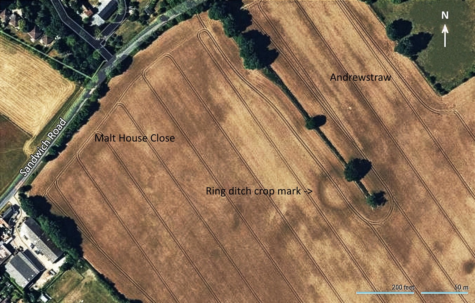
The Bing satellite image of the ring ditch cropmark of the ‘lost’ Easole barrow.
Adjoining to the north-east is a field referred to as Androstraw or Andrewstraw in early 16th century documents. It was later recorded as Pound Meadow on the 1839 parish tithe map and the 1859 Poor Law Commissioners map for Nonington. By the mid-20th century became known as College Field or the Football Field. In the 1950’s and early 1960’s the field was used by the Nonington football club as their home ground. The changing facilities for both teams was in the Youth Club building next to the Baptist Chapel in Easole Street.
During the later part of the Second World War the field was used to stored damaged vehicles awaiting repair that had been sent back from the Northern European battle fields.
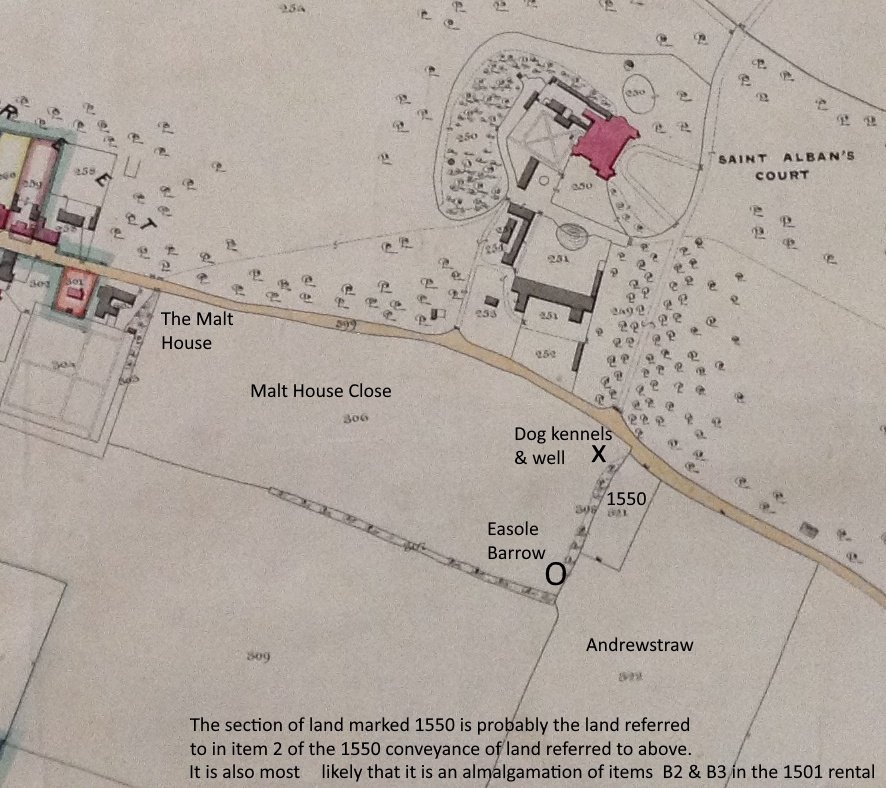
A section of the 1859 Poor Law Commissioners map of the old parish of Nonington showing the barrow site.
From the satellite image, Keith Parfitt, a well-known and respected East Kent archaeologist, assessed that the ring-ditch cropmark had an external diameter of about 44 metres. As a continuation of Dover Archaeological Group’s [DAG] ongoing Easole (Nonington) Landscape Project, and with the ready consent of the land-owner, Mr M. Solley, Keith led and supervised members of the DAG in a field walk across the area of the ring ditch crop mark in September of 2024.
On the ground, the precise location of the ring-ditch cropmark was found to be marked by a low but quite distinct mound of clay. Along the north-eastern side, this ran into the field boundary, which was here represented by a well-defined lynchet bank that falls away by about one metre down to the adjacent field [Andrewstraw].
The mound itself was around 51.00m across parallel to the field boundary (NW–SE) and extended into the field for a distance of about 45.00m (NE–SW). The highest part rose some 0.50m above the surrounding field surface, but there was no surface indication of the encircling ditch.
A thorough search of the mound area was made by members of the DAG and finds included a light to moderate scatter of burnt/calcined flint along together with seventy-four prehistoric struck flints but they were mostly waste flakes, with very few recognisable tools. A total of fourteen sherds of pottery were also collected: eight post-medieval, two sherds of medieval sandy ware, and three small pieces of Belgic/Roman grog-tempered ware. A somewhat abraded fragment of flint-tempered prehistoric pottery was also discovered which appears to be Iron Age, rather than Bronze Age, in date.
The finds recovered in 2024 have been incorporated into the main Easole Landscape Project archive, housed at Old St Albans Court.
++++++
A paper recording the discovery and investigations into the Easole Barrow has just been published [June, 2026] in volume 147 of the Archaeologia Cantiana, the year book of The Kent Archaeological Society, by Keith Parfitt.
Parfitt, K., 2026, ‘A new ring-ditch cropmark and the rediscovery of a lost barrow at Easole’, Archaeologia Cantiana , Volume 147, pp. 325-327. Maidstone: Kent Archaeological Society.